


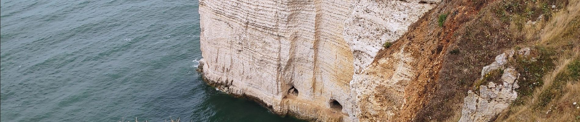
camping Antijune_pointe de la Courtine et retour

gdela
User
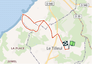

Length
8 km

Max alt
109 m

Uphill gradient
94 m
Km-Effort
9.3 km

Min alt
32 m

Downhill gradient
95 m
Boucle
Yes
Creation date :
2020-07-24 12:21:51.004
Updated on :
2020-07-26 15:52:44.231
1h51
Difficulty : Easy

FREE GPS app for hiking
 SityTrail
IGN / Geographical institutes
SityTrail Plus
The world is yours!
About
Trail Walking of 8 km to be discovered at Normandy, Seine-Maritime, Le Tilleul. This trail is proposed by gdela.
Photos

Positioning
Country:
France
Region :
Normandy
Department/Province :
Seine-Maritime
Municipality :
Le Tilleul
Location:
Unknown
Start:(Dec)
Start:(UTM)
298979 ; 5507109 (31U) N.
Comments